This winter’s forecast: snow, snow and more snow
The winter forecast is out and it looks very promising for Last Frontier Heliskiing.
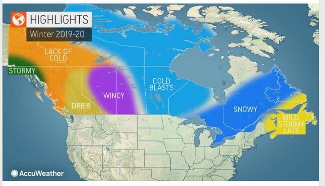
The company AccuWeather, which has provided global forecasts since 1962, just released its winter prediction for 2019-2020. And its forecast? Snow. Lots of it, at least for the North coastal areas of British Columbia – home of Last Frontier.
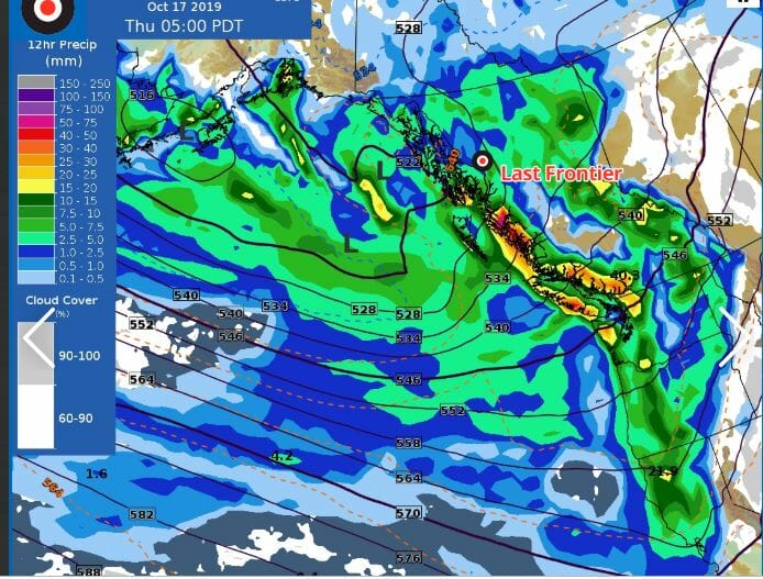
While AccuWeather predicts that most of B.C. will be drier than normal, there’s a small sliver in the northwest that will be stormy, which conveniently is right in our backyard. Score!
“The main storm track will likely bring the bulk of rain and snowfall events to northwestern British Columbia this winter,” said Brett Anderson, AccuWeather’s Canadian weather expert.
According to that forecast, out of the 22 heliskiing operators across B.C., Last Frontier Heliskiing will be one of the snowiest.
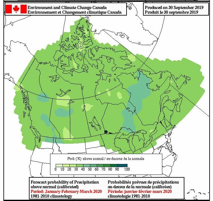
Regardless, AccuWeather isn’t alone in its predictions. The Farmers’ Almanac says “above normal precipitation” for this winter and weather charts from Environment Canada predict a 30 per cent chance for above normal snowfalls.
What is an average snowfall at Last Frontier Heliskiing?
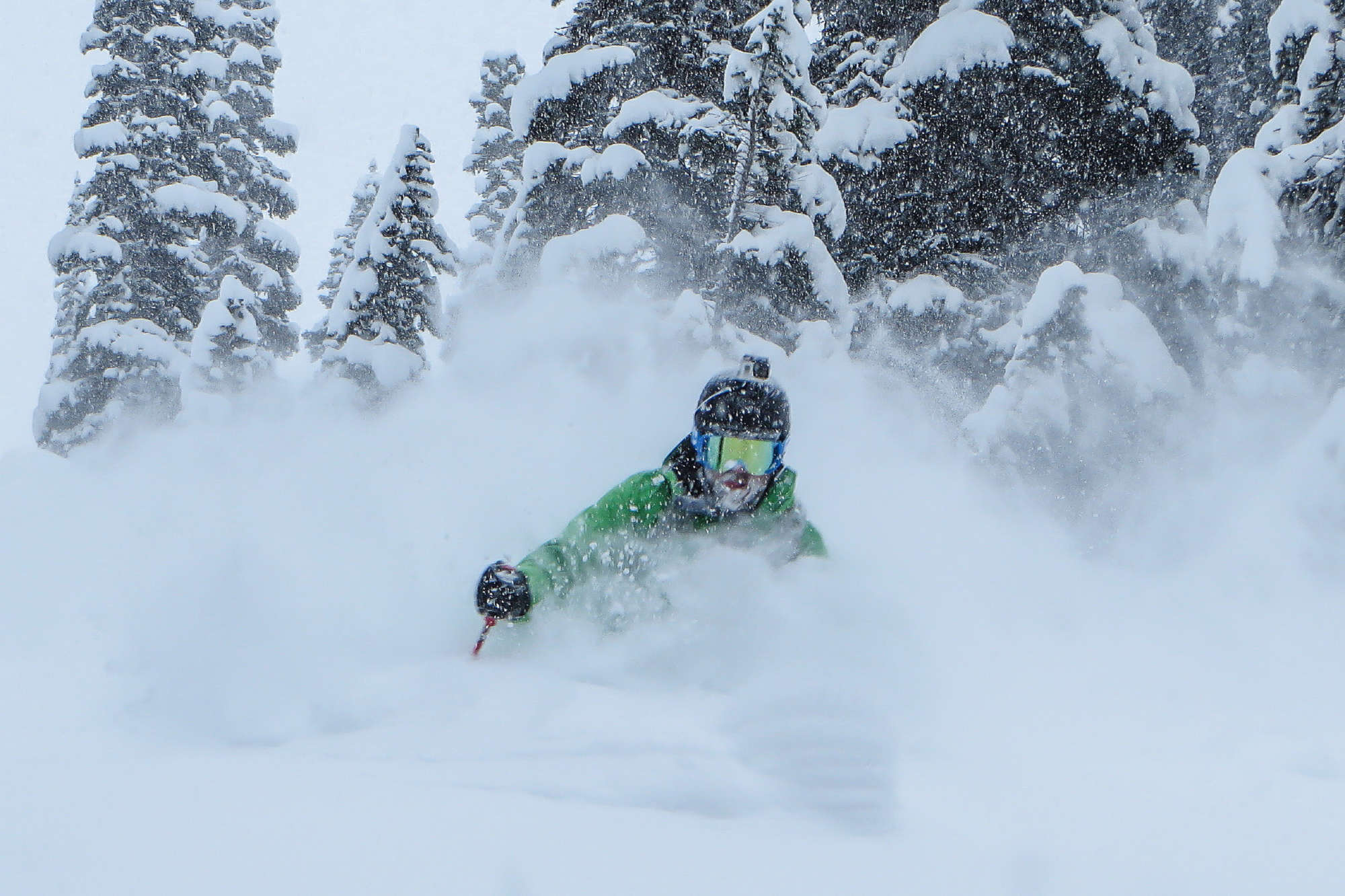
For both its ski operations, Ripley Creek and Bell 2 Lodge, the average seasonal [Late December to mid-April] snowfall is around 7.5 metres. That’s higher than a British double-decker bus. With an average seasonal temperature of minus 5 degrees, it’s the perfect ski weather. Not too cold, but not too warm. When it snows, there’s a good chance it will be light and airy, like skiing through a cloud.
How is it looking so far?
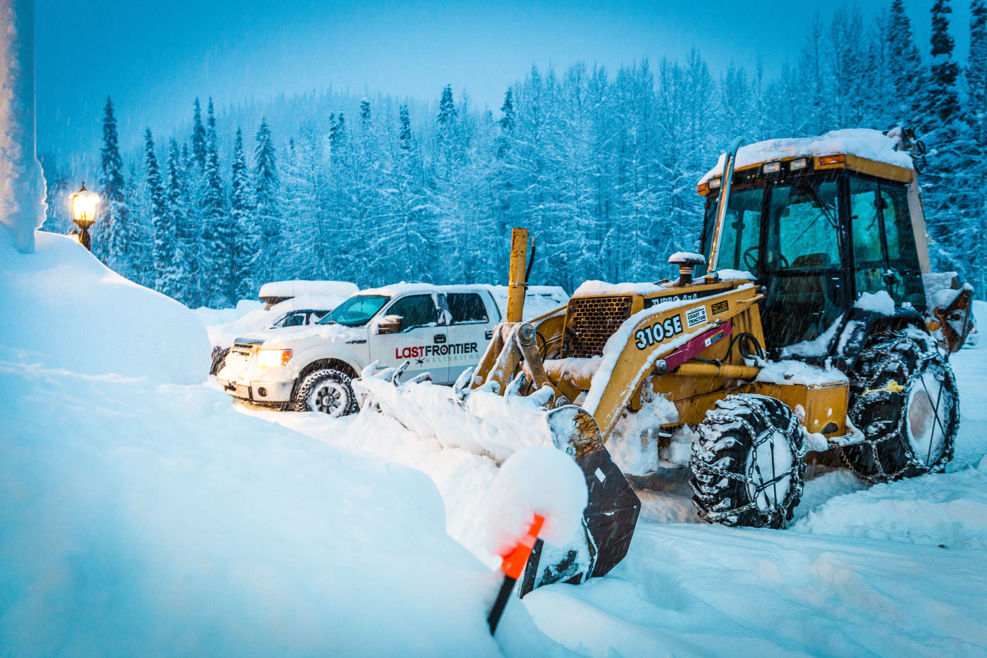
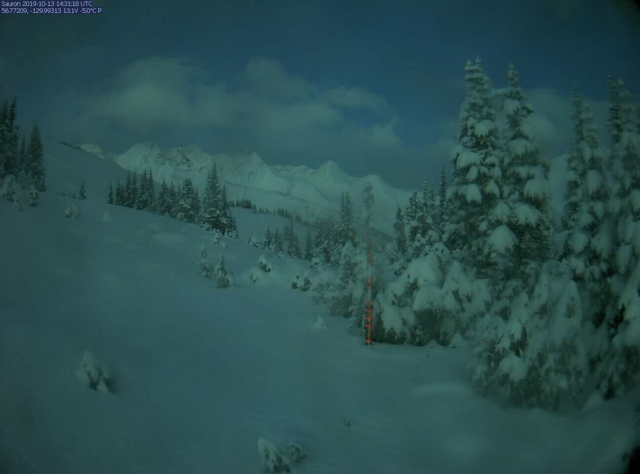
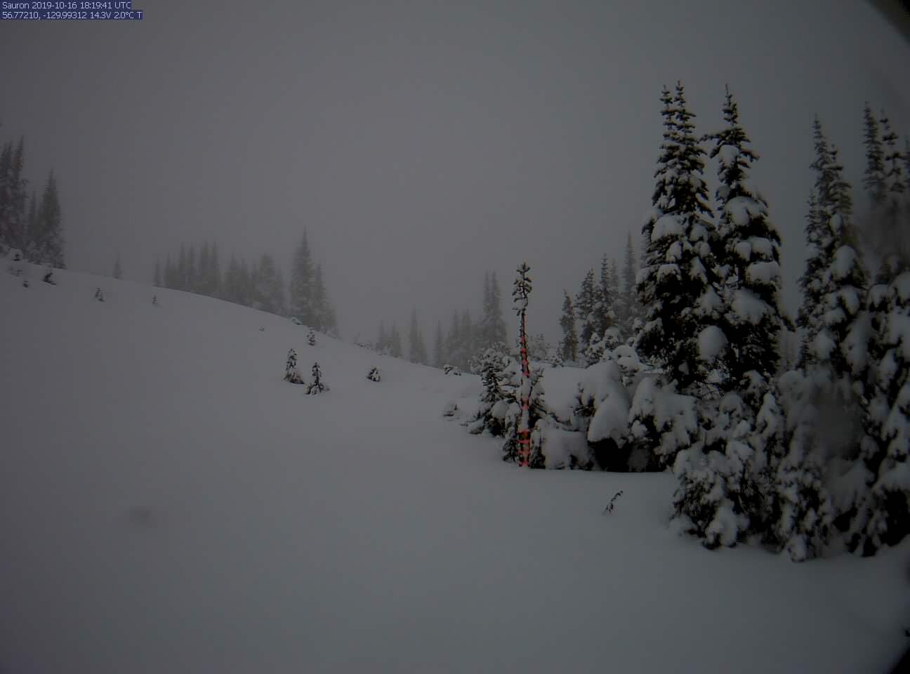
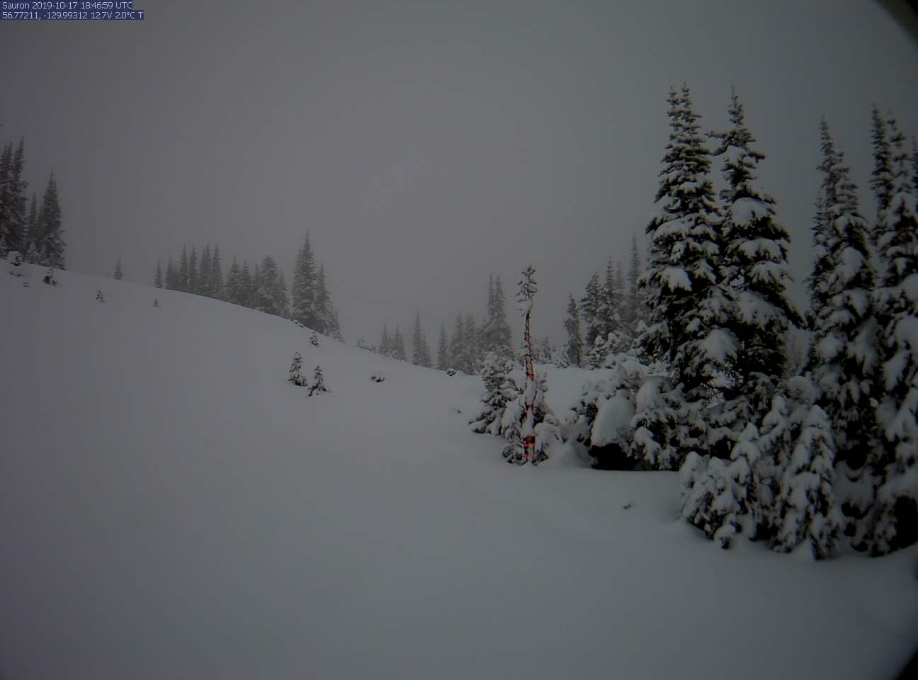
It’s barely autumn and already Old Man Winter has hit Last Frontier Heliskiing. At the top of our run Mucho Gusto at 1,300 metres, there’s 70+ cm of fresh pow. This time last year, there was only yellowing grass and falling leaves. Not a snowflake in sight. Despite last winter’s below average snow levels, it turned out to be an above average year for vertical skied. So what does it all mean for this winter?
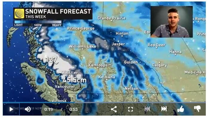
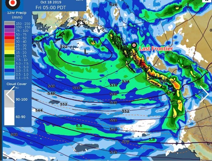
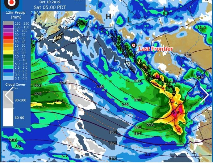
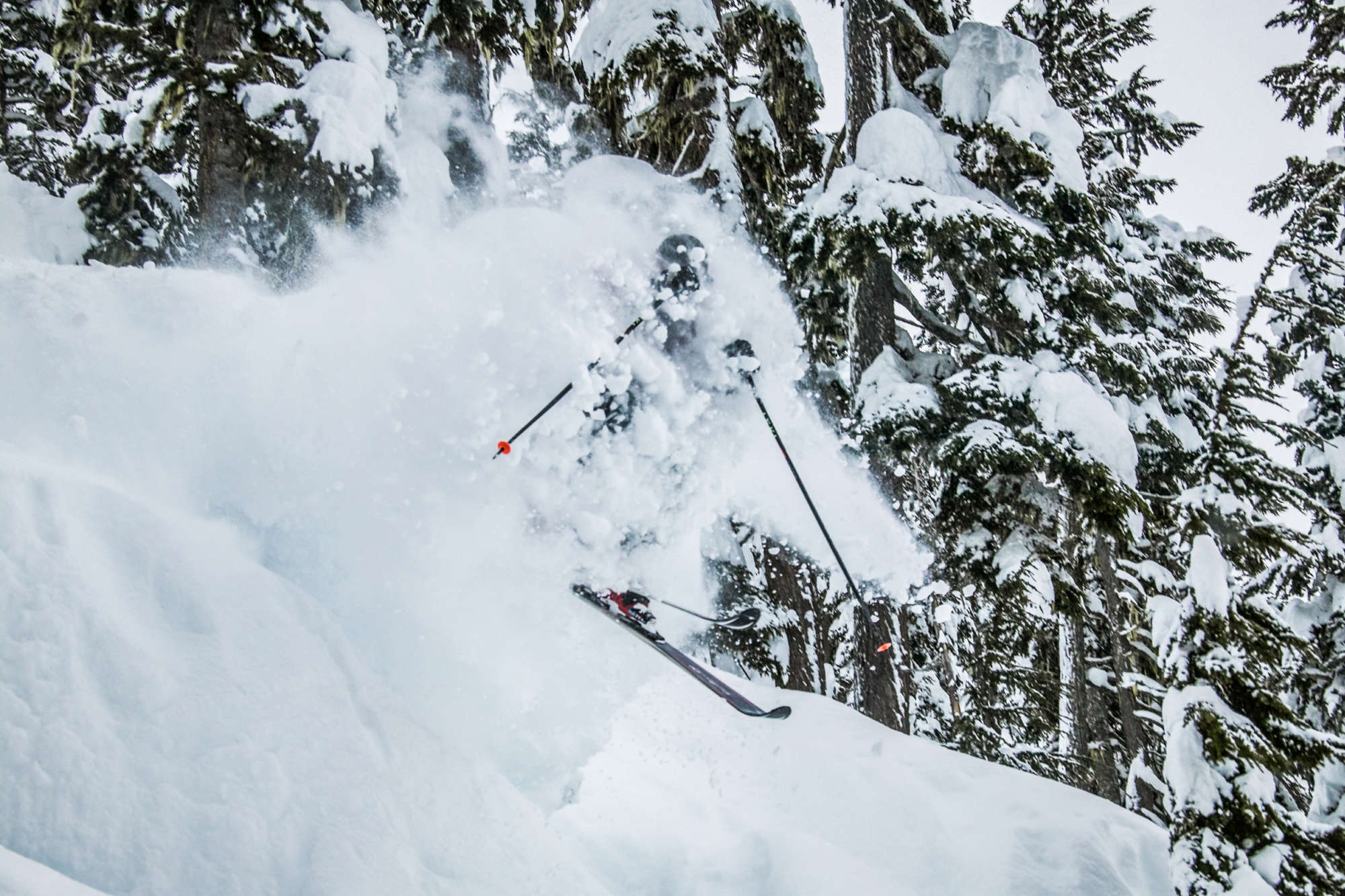
The Weather Network says it will continue to snow this week. There’s a persistent trough off the coast of northwest B.C., which will feed round after round of snow into the coastal mountains, delivering more than 1 metre of fresh snow above 1,800 metres.
It appears the ski season may be off to an early start. *insert happy dance*
Will this winter compete for the most epic of all?
One of the winters with the highest snowfalls was 2012, when over 10 metres fell between late December and early April. While it’s too early to say, but so far, winter 2019-2020 looks exciting. Time to wax those skis, waterproof the snow pants and grow that 1980’s mustache.
Of course, weather forecasts always have to be taken with a grain of salt. It’s tricky predicting the future. Even getting the weather right next week in downtown Toronto can be a struggle, let alone on the Coastal Mountains in one of the remotest areas in Canada. There’s always a chance that a predicted storm will petter out beforehand and when it hits, it’s only sunshine and lollipops. Regardless, both are pretty good for skiing.
If you’re worried that the predictions for the upcoming season might mean more down days – don’t be. Although 2012 has one of the highest snowfalls on record, it also has the highest average vertical skied per week at more than 52,000 metres [172,000 feet]. So even if it’s dumping snow, the chances are our guests will get outside to enjoy it.
Related Posts
About Liam Harrap
Liam grew up in Jasper, Alberta – a perfect place for scrambling pointy things and survival skiing. Liam loves to travel to cold and miserable places, as long as he has a steaming mug of tea and good grub to fry in bacon fat. While Liam used to work for Last Frontier Heliskiing as a radio operator at Ripley Creek, he is now a journalist/ski bum in Revelstoke, B.C.View all posts by Liam Harrap